Two weeks in the Andes: Lima to the Uyuni salt flats
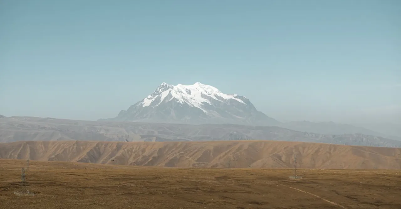
Two countries in fourteen nights, from the Pacific up onto the altiplano. Only two legs are actually trains, because South America has very little passenger rail left, and one of the trains sold to you as a train is partly a bus. Budget 500 MB to 1 GB a day on one regional eSIM.
Contents
- The route, leg by leg
- Where your phone stops working like home
- Lima, two nights
- Lima to Cusco
- Cusco, five nights
- The Machu Picchu leg, and why it is not quite a train
- Cusco to Puno
- Puno, two nights
- Puno to La Paz
- La Paz, two nights
- La Paz to Uyuni, the one real train
- Uyuni, three nights
- Altitude, and what it does to your phone
- How much data two weeks here needs
- Before you go
- Booking and official sources
Most rail trips are planned around the trains. This one has to be planned around their absence.
South America once had a continental network and now has fragments. What survives on this route survives because nothing else goes there, and knowing which two legs those are is the difference between a smooth fortnight and a very long day at a bus terminal.
The route, leg by leg
Fourteen nights across five bases and two countries. One leg is a flight, two are trains, and the rest are buses. Times are indicative and worth rechecking at booking, because the Peruvian legs changed shape during 2026.
| Leg | How | Time | Nights |
|---|---|---|---|
| Lima | Arrive by air | - | 2 |
| Lima to Cusco | Flight. The bus is 20h+ and climbs 3,400m | About 1h25 | 5 |
| Cusco to Puno | PeruRail Titicaca, now bus plus train | About 10h | 2 |
| Puno to La Paz | Bus, crossing at Desaguadero or Kasani | About 7h to 8h | 2 |
| La Paz to Uyuni | Bus to Oruro, then the Oruro to Uyuni train | About 3h, then 7h | 3 |
Run it in reverse if you are flying home from Santiago or crossing into Chile at the end. The connectivity advice does not change with direction. The altitude advice does: going south to north you arrive in Cusco already acclimatised, which is easier on you and on your battery.
Where your phone stops working like home
This is the part almost every Andes itinerary skips, and the part most likely to cost you money.
You may have read that roaming charges were abolished across the Andean Community. That is true. It is also, almost certainly, irrelevant to you.
Decision 854 took effect on 1 January 2022 and removed roaming surcharges between Bolivia, Colombia, Ecuador and Peru. Peru's transport ministry set out the terms when it came into force: it covers postpaid plans, held by residents of those four countries, using the same line number.
The Andean roaming agreement is real and it is not for you. It applies to postpaid lines issued in Bolivia, Colombia, Ecuador or Peru, travelling within those four. A European, North American or Asian SIM gets nothing from it, and neither does a prepaid Peruvian one.
So for a visitor there are three options and one of them is quietly enormous. Roaming on your home plan works everywhere on this route and can cost more than the flights. A local SIM is cheap per gigabyte and now hard to buy, and a regional eSIM covers both countries on one plan.
The middle option is the one that changed. Peru's regulator OSIPTEL requires biometric identity validation to activate a prepaid line, checked against the immigration database, and it has to be done in person at an operator's own service centre. Fingerprints in a shop in Cusco is a real way to spend an afternoon.
Bolivia is less strict and more scattered. Registration is lighter, but coverage on the altiplano is the constraint rather than paperwork, and the useful shops are in La Paz rather than Uyuni.
The practical answer is the boring one: one regional plan, installed before you leave, so the Desaguadero border is a change of scenery rather than a change of tariff.
Lima, two nights
Two nights, and they are for acclimatising to the trip rather than the altitude. Lima is at sea level, which is the last time that will be true for a fortnight.
Miraflores and Barranco are where most people stay and where the coastline is worth the walk. The centre is a bus or taxi away and worth half a day. Do not schedule anything demanding: you will fly to 3,400m on day three.
Lima to Cusco
Fly. This is the one leg where the alternative is not a close call: the bus takes over twenty hours and climbs from sea level to 3,400m while you sleep sitting up, which is the worst possible way to meet altitude.
The flight is about an hour and twenty-five minutes and there are many a day. Book a morning departure. Afternoon flights into Cusco are the ones that get turned back by weather, and being bumped to tomorrow costs you a night of a five-night base.
Cusco, five nights
Five nights sounds generous and is not. Two of them are gone to Machu Picchu, one goes to the Sacred Valley, and the first is the one where you sit still and drink coca tea because you have just arrived at 3,400m.
Cusco itself deserves the rest. It is an Inca capital with a Spanish city built on top of it, literally: the cathedral sits on Inca foundations you can put your hand on, and the stonework in the streets around Hatun Rumiyoc is the reason people come back.
The Machu Picchu leg, and why it is not quite a train
There is no road to Machu Picchu. You walk for four days or you take the train, which is why this is the one rail leg on the route that nobody skips.
What has changed is where the train starts. PeruRail now runs a bimodal service: a bus from Cusco to the railhead, then the train to Aguas Calientes. Since 1 September 2025 selected departures transfer at Pachar rather than Ollantaytambo.
The seasonal part matters more. For the 2026 dry-season timetable the direct train from Poroy runs roughly May to December, and outside that window the Cusco to Ollantaytambo leg is a mandatory bus. A January itinerary and a July one are different trips, and most blog posts describe only one of them.
If a guide tells you to board a train in Cusco and get off at Machu Picchu, check the month it was written for. Between roughly January and April 2026 the first part of that journey is a coach, whatever the ticket calls it.
Book the train well ahead in either case. Capacity to Aguas Calientes is finite, entry tickets to the site are timed and sold separately, and the two sell out independently of each other.
Cusco to Puno
The second rail leg, and the second one that is not purely rail. PeruRail's Titicaca service is currently listed on its own status page as a bus and train combination rather than a through train.
Taken as a day out it is still worth it. The route crosses La Raya at 4,338m, which is the highest you will go on this trip, and the scenery between Cusco and the lake is the reason to do it in daylight rather than take the overnight bus.
If the schedule does not fit, buses run the same corridor in about seven hours and cost a fraction. This is a leg to choose on your budget rather than your principles.
Puno, two nights
Puno is not a beautiful town and Lake Titicaca is worth the stop anyway. At 3,830m it is also the highest place you will sleep before La Paz, which makes it useful acclimatisation whether or not you planned it that way.
The floating Uros islands are the obvious excursion and are exactly as touristed as you expect. Taquile, further out, is the one people remember.
Puno to La Paz
A bus, and the leg where the routing matters. Most services cross at Desaguadero, which is direct and dull. The alternative goes via Copacabana and the Kasani crossing, adding a lakeside town and a ferry over the Strait of Tiquina.
Either way you are leaving the Andean Community's roaming area in the sense that matters to you, which is to say nothing changes, because it never applied to your SIM.
Budget an hour at the border on a full coach. Bolivian entry requirements vary by nationality more than most countries on this continent, and a few passports still need a visa arranged in advance, so check yours before you book anything.
La Paz, two nights
La Paz is the most physically startling city on the route. It is built into a canyon, the rich live at the bottom where the air is thicker, and the public transport is a cable car network that doubles as the best sightseeing in the city.
Two nights is enough for the Mi Teleférico lines, the Mercado de las Brujas and a look at the Valle de la Luna. Three if you want Tiwanaku, though at 3,640m most people find La Paz tiring rather than restful.
La Paz to Uyuni, the one real train
This is the leg the whole route is built around, and the only genuine long-distance passenger train on it.
You take a bus to Oruro, about three hours, and pick up the railway there. Two services run the Oruro to Uyuni stretch in around seven hours: the faster Expreso del Sur and the slower Wara Wara del Sur, each running a couple of times a week in each direction.
The difference between them is the point. The Expreso stops only at the main stations. The Wara Wara stops at all twelve, including altiplano villages that have no other public transport at all, and costs less to do it.
Both Bolivian trains run twice a week, not daily. Work out your Uyuni dates before you book anything else on the Bolivian half, because the train timetable is the least flexible thing on this route.
Neither runs every day, which is the constraint people discover too late. If the dates do not work there are overnight buses from La Paz to Uyuni, and they are a genuinely worse experience on a genuinely worse road.
Uyuni, three nights
Three nights, and only one of them is really about the town. Uyuni is a supply post that exists to send you somewhere else.
The salt flat is the somewhere else. Day tours run onto the Salar and back; the two and three-day versions carry on south through the coloured lagoons towards the Chilean border, which is also the standard way to leave for San Pedro de Atacama if you are continuing.
In the wet season, roughly December to April, a film of water turns the Salar into a mirror. In the dry season you get the hexagons and firmer ground for driving. They are different photographs and different trips.
Altitude, and what it does to your phone
This is the section no European rail guide needs and this one does.
You will spend eleven of fourteen nights above 3,300m, and cold thin air is hard on batteries. A phone that lasts a day at home will not last a day on a salt flat tour at 3,670m in a vehicle with no charging.
| Where you sleep | Altitude |
|---|---|
| Lima | Sea level |
| Cusco | 3,400m |
| Aguas Calientes | 2,040m |
| Puno | 3,830m |
| La Paz | 3,640m |
| Uyuni | 3,670m |
| La Raya, the high point of the Puno rail leg | 4,338m |
Carry a power bank and keep the phone in an inside pocket rather than an outside one. Cold drains it faster than the screen does.
Coverage follows the roads and the towns, and both are sparse up here. Cusco, Puno, La Paz and Uyuni town are all fine. The gaps are the long stretches between them, the Salar itself, and the lagoon route south towards Chile, where there is nothing for hours at a stretch.
How much data two weeks here needs
This route is map-heavy, translation-light and upload-heavy, because the landscape is the point and you will photograph all of it.
| What you are doing | Rough daily use |
|---|---|
| Maps and offline map refreshes | 150 to 300 MB |
| Photo and video sharing, higher than you expect here | 200 to 400 MB |
| Messaging and tour operator admin over WhatsApp | 100 to 200 MB |
| Checking bus and train times, mostly by browser | 50 to 150 MB |
| Translation, menus and signage | 30 to 80 MB |
That puts most people between 500 MB and 1 GB a day, so 10 GB covers the fortnight. Take 20 GB if you are working from the road, and remember you will not be topping up in Uyuni.
Before you go
- Install the eSIM at home on wifi. Doing it in Lima airport is fine; doing it in Uyuni is not.
- Download offline maps for both countries, including the stretch between Oruro and Uyuni. That is where you will want them.
- Fix your Uyuni train dates first and build the rest of the trip around them. Two departures a week is the tightest constraint on the route.
- Book Machu Picchu train tickets and site entry separately, and early. They sell out independently.
- Check whether your Machu Picchu departure is a train or a bus-plus-train, which depends on the month you travel.
- Carry a power bank. Eleven nights above 3,300m is hard on a battery, and salt flat tours have no sockets.
Booking and official sources
- PeruRail sells both Peruvian rail legs and is the only place the bimodal arrangement is stated plainly.
- Bolivia's Expreso del Sur and Wara Wara del Sur timetable has the twice-weekly departures. Ferroviaria Andina's own site was unreachable when this was written, so treat the times as indicative and confirm at the station.
- OSIPTEL, Peru's telecoms regulator, is where the prepaid registration rules are published if you want the source rather than a shop's account of them.
- Peru's Ministry of Transport and Communications set out who the Andean roaming decision actually covers, which is the fact most travel writing gets wrong.
- Tren Ecuador's service board is worth a look if you were considering adding Ecuador by rail. Most of the network, including the Tren Crucero, is marked suspended.
Can I do this route entirely by train?
No, and nothing close to it. South America has very little passenger rail left. On this itinerary one leg is a flight, two are buses, and of the two rail legs the Machu Picchu service is partly a bus for much of the year. The one full train journey is Oruro to Uyuni in Bolivia.
Does the Andean Community roaming agreement help me?
Almost certainly not. Decision 854 removed roaming surcharges from 1 January 2022, but it covers postpaid lines held by residents of Bolivia, Colombia, Ecuador and Peru travelling within those four countries. A SIM issued anywhere else is outside it, and so is a prepaid local one.
Is the train to Machu Picchu really a bus?
Partly, and it depends when you go. PeruRail runs a bimodal service where a coach covers Cusco to the railhead and the train takes over from there, with some departures transferring at Pachar since September 2025. The direct train from Poroy runs in the dry-season months. Check the month you are travelling, not a blog post from another year.
How far ahead do I need to book the Bolivian train?
Further than you think, because it is the timetable rather than the seats that constrains you. The Expreso del Sur and the Wara Wara del Sur each run twice a week in each direction, so a missed connection is a three-day wait rather than a three-hour one. Fix those dates before anything else.
Will one eSIM cover Peru and Bolivia?
Yes, on a regional plan rather than two single-country ones. That is the main practical argument here: two countries, no roaming agreement that includes you, one plan that does not care where the border is.
How bad is coverage on the salt flats?
Assume none. Uyuni town is fine, and the Salar itself and the lagoon route south towards Chile are effectively offline for hours at a time. Download your maps before you leave town, and treat the tour days as time away from the network rather than a connectivity problem to solve.
Get a travel eSIM for 200+ destinations in under a minute.
Get your South America eSIM →

